Research
My current work at MIT focuses on developing probabilistic, hyper-resolution flood-inundation risk maps for vulnerable regions worldwide—such as Bangladesh, Southeast Florida, Puerto Rico, and Boston—under various climate scenarios, using a multidisciplinary, ML-accelerated downscaling–hydrodynamic modeling framework. This research addresses the impacts of climate extremes—particularly tropical cyclones, seasonal extreme rainfall, and sea-level rise—and aims to empower frontline communities by enhancing disaster resilience, strengthening coastal strategies, and advancing climate adaptation.
I summarize my past, current, and future work into four themes:
1. Integrated ocean–estuary–river-network hydrodynamics for tide–surge–inflow coupling
Unified, multi-scale domains connect shelves, estuaries, and dense river networks to capture nonlinear tide–surge–river interactions that standard coastal models miss; methods include open, reproducible meshing/workflows. See Earth’s Future (link) for the Pearl River Delta and One Earth (link) for Bangladesh. I also developed a physics-informed rating-curve framework for upstream discharge reconstruction; see Journal of Hydrology (link) and Advances in Water Science (link).
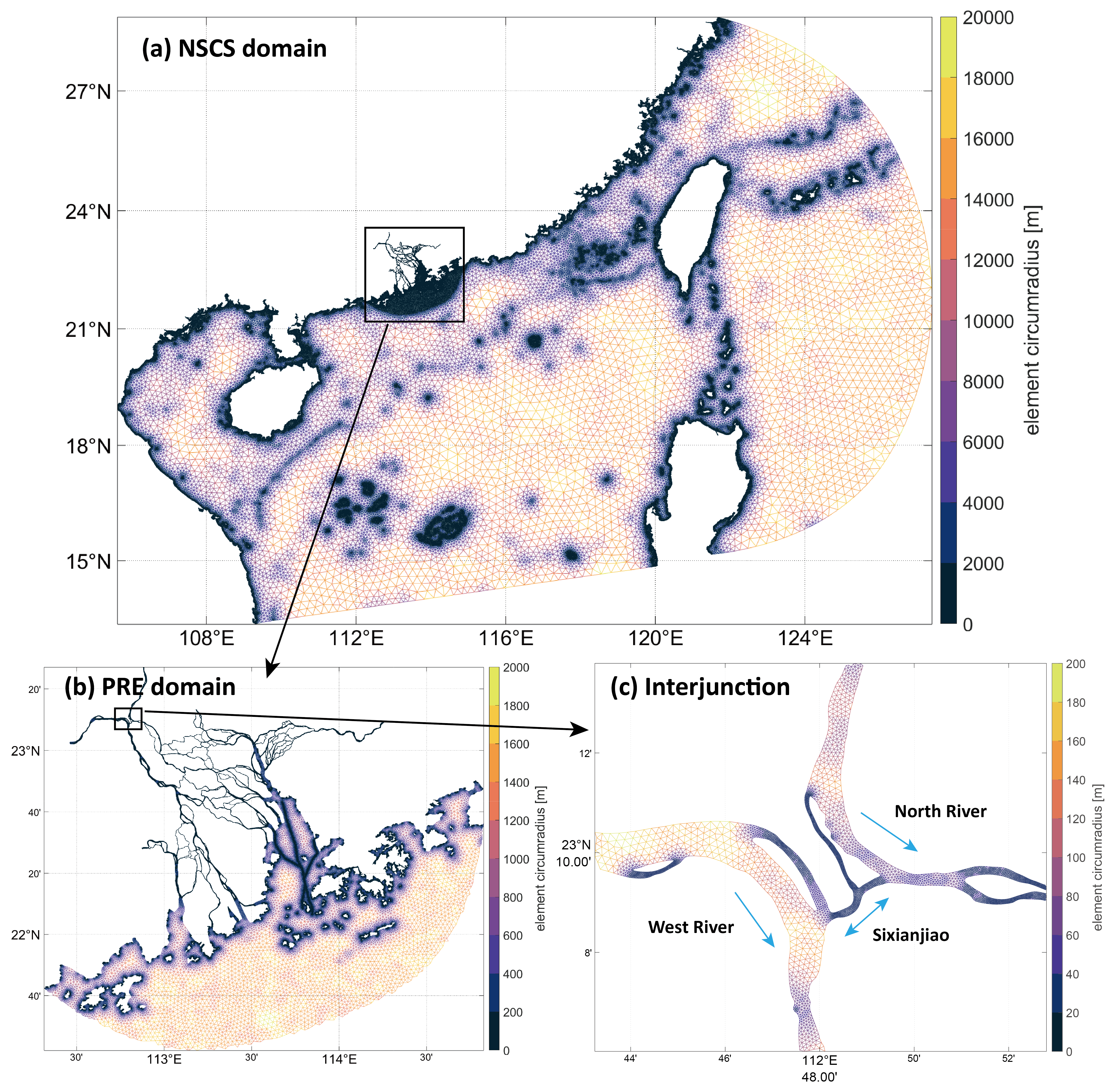
2. Physics-based storm-tide risk assessment for mega-deltas under warming scenarios
To quantify future storm-tide risk, I use storyline-based stress testing and TC downscaling–hydrodynamic chains to estimate design water levels (e.g., 50–1,000-yr) and long-horizon risk under sea-level rise and evolving cyclone characteristics, with explicit uncertainty for adaptation. See Earth’s Future (link) and One Earth (link).
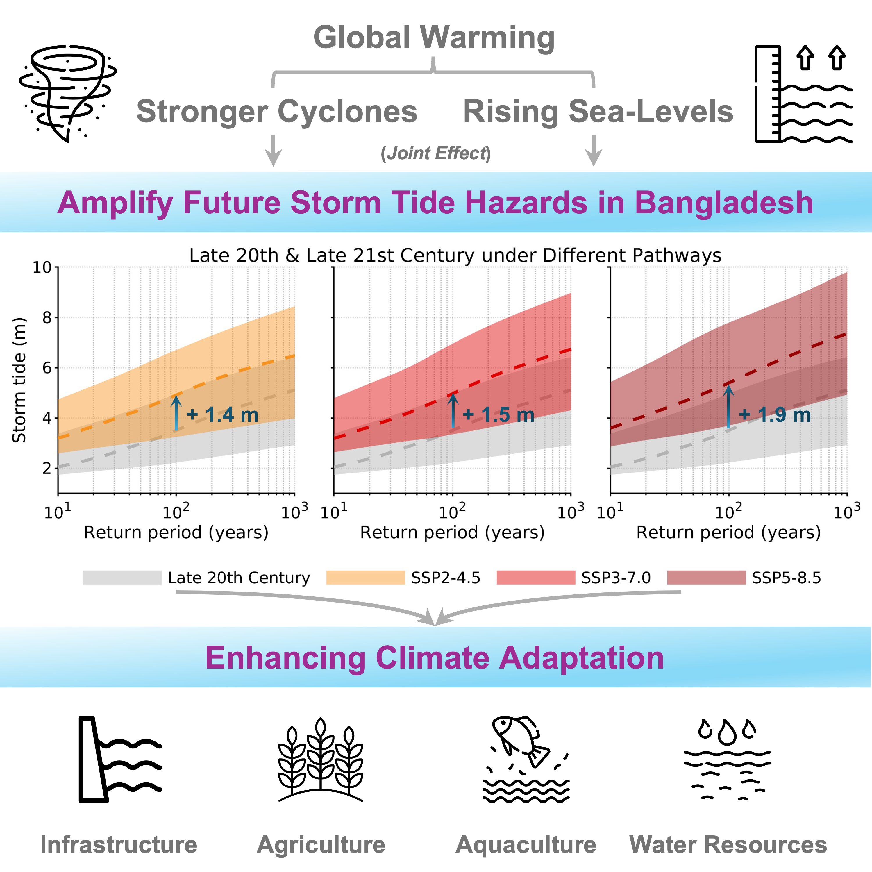
3. Hyper-resolution compound/cascading flood mapping for frontline adaptation (ongoing work)
Fast hydrodynamics, TC and rainfall downscaling, and active-learning triage produce ~30 m inundation layers integrating surge, tides, river inflow, and extreme rainfall—including multi-event cascades—for decision-ready community products.
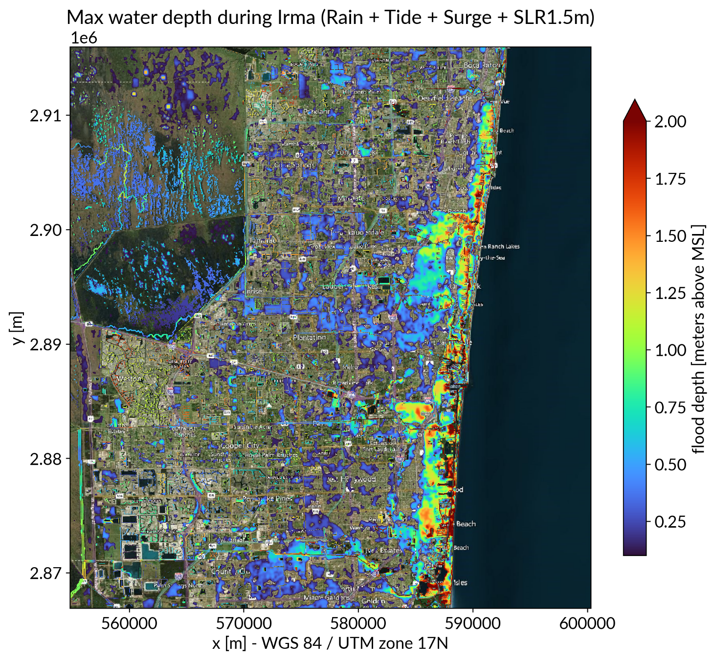
4. Post-landfall flood early warning at basin–city scales (future direction)
I am developing an operational pipeline that links week-ahead TC forecasts to rapid inundation prediction for emergency response (coupling pluvial–fluvial–coastal dynamics to generate compound/cascading inundation maps).